Pole Inspection Graphic Reporting Software Enhancements
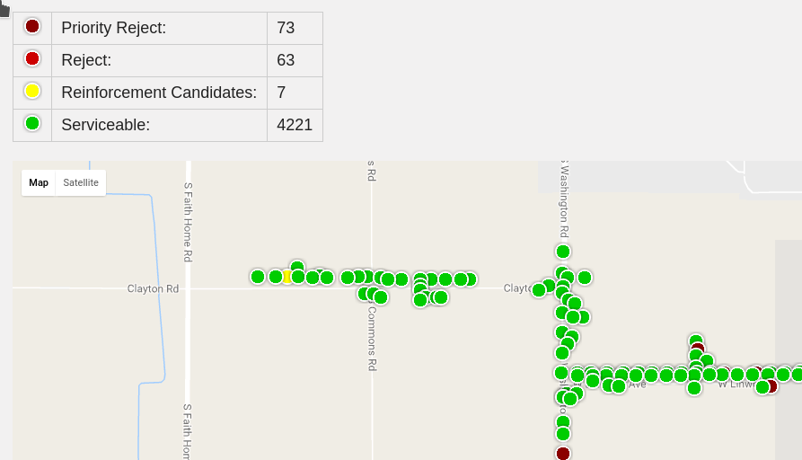
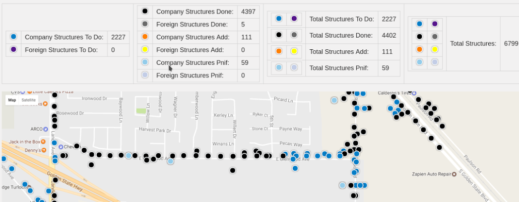
Customers have responded positively to Alamon’s updated graphic reporting tools. The technology gives Alamon supervisors, technical leads and clients a quick visual overview of project progress in the field. It also offers much faster response times for dispatch of personnel and for customer requests. We utilize Google Maps, which allows for the display of more information on each data point. The maps are aligned with the data as seen on tablets used by Alamon field staff, and a quick toggle takes the user from map view to terrain view to satellite overlay.